A Concentration of Construction
![Geographic map of Sainte-Anne Sainte-Marie Sainte-Elisabeth and d’Orvilliers villages of Sainte-Marie Rapide Sud and Rapide Nord lanes of îles Saint-Ignace and île des Pins of Petit Chenail and Lower Sainte-Anne showing the population density by zone with red and orange color marks.](https://www.communitystories.ca/v2/histoire-seigneuriale_seigneurial-history/wp-content/uploads/sites/116/2021/10/2021-Carte-9ENG-1.jpg)
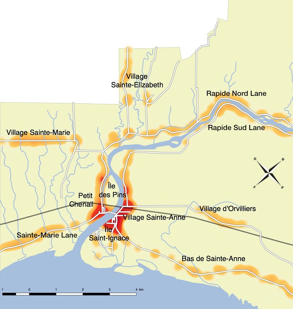
Concentration of construction in Sainte-Anne-de-la-Pérade at the beginning of the 20th century, topographic map, 2017, François Antaya.
Source: Domaine seigneurial Ste-Anne
At the beginning of the 20th century, the concentration of construction clearly demonstrates the formation of the Sainte-Anne-de-la-Pérade village’s heart, emerging near île Saint-Ignace and village Sainte-Anne.