

Origins of Oshawa and Lake Ontario
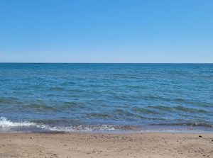
Lake Ontario, Lakeview Park Oshawa, Ontario. 2021
Lake Ontario’s name comes from the Iroquoian word “Oniatarí:io,” and means “lake of shining waters.”
Located in the traditional territory of the Mississaugas of Scugog Island First Nation, the City of Oshawa (incorporated as a city in 1924) sits on the north shore of Lake Ontario.
Transportation is woven through the history of Oshawa. The name Oshawa suggests transportation and travel, the point where the water ceases and travel by land begins. Oshawa comes from the Ojibwa term aaz haway, whose meaning is disputed but believed to be “crossing place.” The natural harbour on the site formed part of an early trade route between Lake Ontario and the inland river network that includes today’s Oshawa Creek and Farewell Creek.
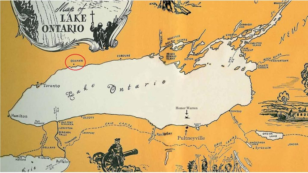
Early map showing location of Oshawa to York/Toronto and Kingston.
Did you know that Lake Ontario started off as a small stream that gradually opened up through the erosion of soft Silurian rocks over thousands of years?
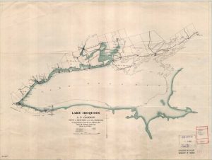
Drawing of Lake Iroquois from 1904, showing the original shoreline in green and the present-day Lake Ontario.
The stream turned into a river that was further widened and sculpted by the powerful movement of the continental glaciers. The current level, shape and direction of flow of Lake Ontario was established over 10,000 years ago.
As it retreated, the glacier left behind Lake Iroquois, a larger version of present-day Lake Ontario. Being so close to the Atlantic Ocean makes Lake Ontario a crucial corridor for transportation and trade.