

Before the Harbour: The Scugog Carrying Place Trail
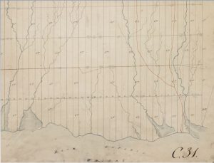
This survey from 1795 of Whitby Township shows the Scugog Carrying Place Trail.
Oshawa has long been a place for transportation and trade, dating back as early as the 1700s when the Mississauga (Michi Saagiig) Anishnaabeg used what is known today as the Scugog Carrying Place Trail.
Indigenous peoples have inhabited the shores of Lake Ontario and the rivers and creeks that flow into it since time immemorial. Years before, seafaring vessels steamed into the Port of Oshawa, and before the pier was built out into Lake Ontario, the Mississauga (Michi Saagiig) Anishnaabeg and other Indigenous groups paid special reverence to the mouth of Oshawa Creek, which led to a marshy inlet where the creek emptied into Lake Ontario.
Worn smooth like a Buffalo run, caused by the action of countless feet for many generations, many years before white men entered this part of Canada.
– Samuel Pedlar Manuscript, Frame # 326, 1904
The Scugog Carrying Place Trail was considered one of four principal routes that connected the interior land to Lake Ontario. This important pathway and portage connected the shore of Lake Ontario, in what is now the City of Oshawa, to the shore of Lake Scugog. This trail crossed the Oak Ridges Moraine and divides the waters flowing into Lake Ontario and those draining into the Trent-Severn Waterway system.
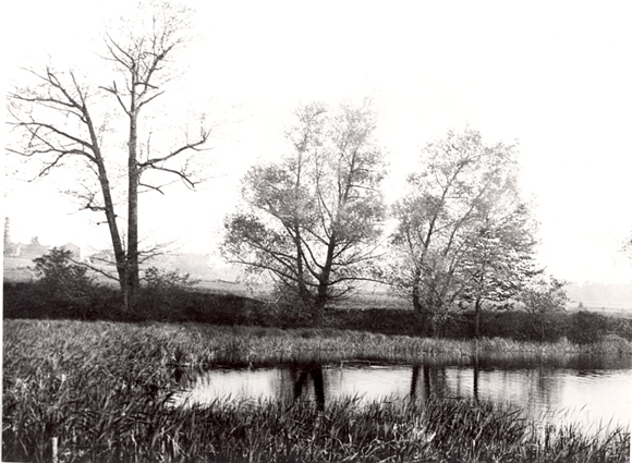
Mouth of Oshawa Creek, 1922.
In an interview, Dave Mowat, the Mississaugas of Scugog Island First Nation’s Consultant, Membership and Land Supervisor in 2017, stated,
there is the Old Scugog Carrying Place Route that came down from the lakeshore at Oshawa made its way up to Lake Scugog here and eventually to Georgian Bay….
About the Scugog Carrying Place Trail. Enjoy this audio clip with an English transcription.
The Scugog Carrying Place Trail was an important footway for seasonal migration and communication used by the last Indigenous peoples, the Mississauga (Michi Saagiig) Anishnaabeg; it’s likely that the Haudenosaunee and Wendat peoples also used the trail before them. In addition to the use of the Carrying Place Trail, Indigenous groups would congregate at the mouth of the creeks in spring and fall to fish.
The site is located on the traditional territory of the Mississauga (Michi Saagiig) Anishnaabeg, Haudenosaunee and Wendat peoples, and spans a portion of the territories covered by the Williams Treaties of 1923 and the Johnson-Butler Purchase (1787-88), known as the Gun Shot Treaty.
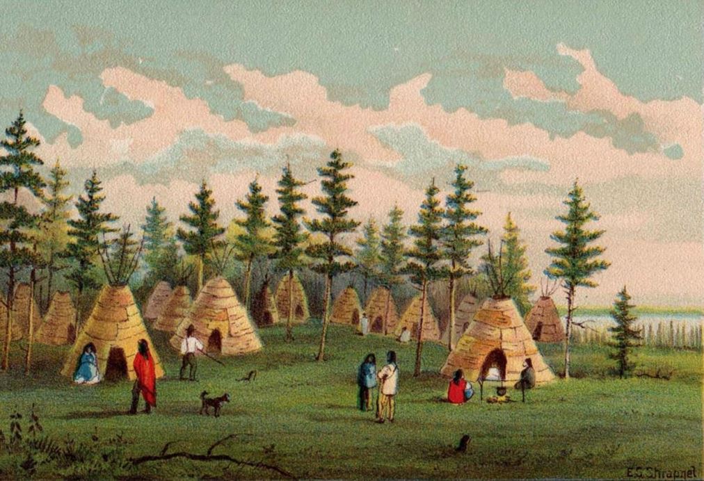
This 1898 painting shows the First Nations population of the Oshawa region in transition, living in traditional bark wigwams, but wearing European-style clothing and cooking in European-made metal pots.
When American and European settlers and colonists began to flood into the lands occupied by the Indigenous peoples, this trail would have been one of the few footpaths through the forest, and thus influenced the settlement patterns of immigrants to the area.