

Early Trade Route
Europeans, seeking trade and inexpensive farmland, colonized the waterfront in the 18th century. On orders from the surveyor general of Upper Canada, Augustus Jones surveyed Whitby Township in 1795. On the survey he noted the Scugog Carrying Place Trail, which begins slightly east of what is known today as Oshawa Harbour. In his field notes, Jones recorded “Wilson’s” to mark the land belonging to the area’s first European settler, now known today as Gifford Hill, and notes that the area where the Oshawa and Farewell Creeks emptied into the lake was called (Min-ce-nan-quash) by the Mississauga (Michi Saagiig) Anishnaabeg peoples.
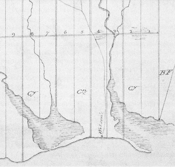
Close-range survey completed by Augustus Jones in 1795, showing First Marsh (current location of Port Oshawa) and Second Marsh (current location of Second Marsh Wildlife Area).
It has been said that around 1750, French colonists established a trading post near the mouth of Oshawa Creek known as the Cabane de Plomb (Cabin of Lead Shot). This was used by the Mississauga (Michi Saagiig) Anishnaabeg for trading until the British conquest of Canada in 1759, when the trading post was abandoned.
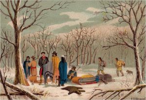
This 1898 painting shows the Mississauga’s trading with European settlers at the southern terminus of the Scugog Carrying Place Trail.
After the French were defeated in the Seven Years’ War in 1763 and most of New France in North America was turned over to the British, they began preparing for an influx of migrants to Upper Canada from the United Kingdom. Other waves of settlement occurred during and after the American Revolutionary War, with the arrival of the United Empire Loyalists and other Americans. Near the southern terminus of the Scugog Carrying Place Trail, one of these American settlers, Captain Benjamin Wilson, received a grant of 200 acres from the Crown, within sight of what would become the Oshawa Harbour. The area’s first settlers were buried on this same land, in what is now known as the Port Oshawa Pioneer Cemetery, which in 1975 was relocated to the west end of Lakeview Park.
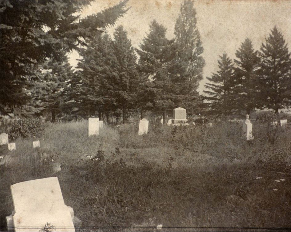
Port Oshawa Pioneer Cemetery in 1902, where the waves of Lake Ontario perform a perpetual requiem to the memory of those interred there.
Within a few years, other settlers joined Wilson in the area, including Roger Conant and Charles Annis, who settled nearby. By the early 1800s, a gradual increase in settlers led to the construction of saw and grist mills and to a viable shipping and shipbuilding infrastructure for exporting local products—all centred around the harbour area.
In 1822, the construction of what would become Simcoe Street, built roughly in parallel with the Scugog Carrying Place Trail, provided improved access to the northern interior land and an additional route for goods to reach the Oshawa Harbour area.