

Columbia River Treaty
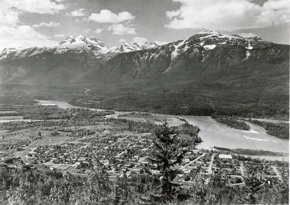
View of Mount Begbie and Revelstoke from Mount Revelstoke lookout, ca. 1945. RMA photo 7990. Photographer: Earle Dickey.
The Columbia River was once teeming with aquatic life that fed other creatures of the land and air. Old-growth cedar forests thrived along its shores.
Indigenous people and later, settlers found abundant resources and a challenging yet satisfying lifestyle closely tied to the river.
This all changed with the signing of the Columbia River Treaty.
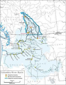
Columbia River Basin Map. Government of British Columbia.
The Columbia River is almost 2000 km long, rising from a spring in Canal Flats, at the base of the Rocky Mountains. It travels north, wrapping around the Selkirk Mountains, then heads south, widening into the Upper and Lower Arrow Lakes before crossing the border with the United States, and winding along until it reaches the Pacific Ocean at Astoria, Oregon. The first 744 km of the river are in Canada.
Clip from the British Columbia Hydro and Power Authority (“BC Hydro”) film “Action on the Columbia” (captions available in both French and English). Enjoy this video with an English transcript.
Canadian Prime Minister John Diefenbaker and President Dwight Eisenhower signed the Columbia River Treaty in Washington, D.C. on January 17, 1961. It was created to control flooding, increase irrigation, and provide water for power generation. The Treaty was negotiated at the highest levels of both governments and became a controversial issue in Canada before it was ratified in 1964.
The Treaty called for the creation of three dams in Canada:
Duncan Dam on Duncan Lake, north of Nelson;
Hugh Keenleyside Dam at Castlegar;
Mica Dam, 150 km north of Revelstoke.
The government did not consult the thousands of people who lived along the Columbia River.
The government did not consult any Indigenous nations or groups.
The government offered little consideration and no compensation for the devastation to the lives of those who were displaced.
The government did not consider the affected ecosystems.
2000 people were displaced by the Hugh Keenleyside Dam reservoir.
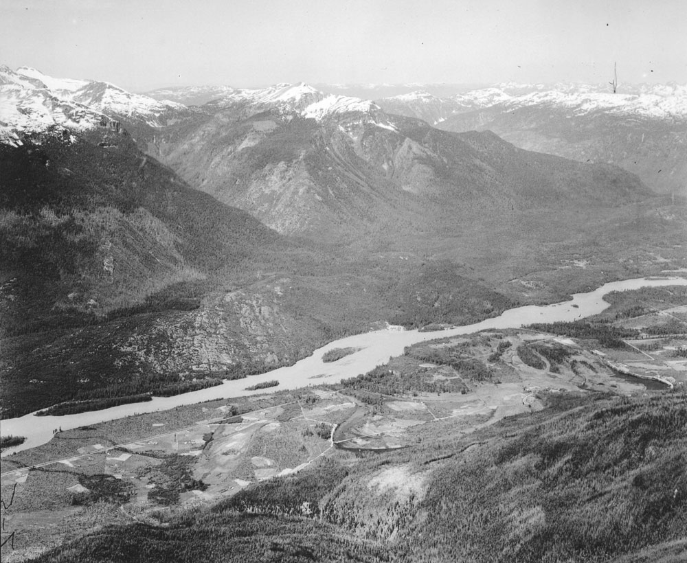
A surveyor who climbed Mount Cartier in 1925 took this photograph of the community that took its name from the mountain. It was a thriving farming community of mostly Ukrainian settlers A photo taken in mid-summer from the same location would show a vast lake where the farms and homes once dominated the valley. RMA photo 4588.