

Beaton
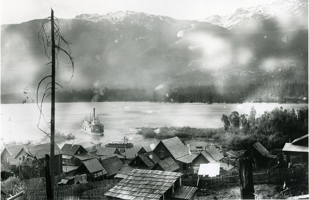
SS Kootenay Approaching Beaton, ca. 1900. Vancouver Public Library photograph 2223. Photographer: Ida (Mattie) Gunterman.
At low water, Don Daem walks along the beach below the few private properties that now make up Beaton. He keeps his gaze on the ground. Sometimes, he sees a rock that may be more than a rock. He has collected dozens of lithics – stone tools used by the Sinixt people.
Beaton was once located at the east end of the northeast arm of the Upper Arrow Lake. It was near a former Sinixt village called nk’mapeleks, which means ‘head of the lake.’ Settlement of the area in the 1890s had pushed out the Sinixt people who were still trying to access their traditional lands for hunting and gathering.
Beaton began life as Thomson’s Landing in 1890, as a gateway into the rich mining territory of the Lardeau region, especially the mining towns of Ferguson, Camborne, and Trout Lake. It was connected to Arrowhead by the steamboat SS Beaton and grew to a small community of about 100 residents. It saw a boom in the 1950s from an upswing of mining and logging activity in the area.
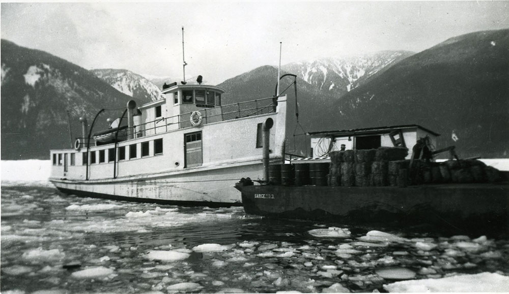
SS Beaton on icy water with a barge, 1953. RMA photo 6057. Photographer: Doris Warkentin.
The small steamboat SS Beaton travelled between Arrowhead and Beaton, and during the winters, made weekly trips to keep the channel open. The SS Beaton towed a barge that could accommodate automobiles.
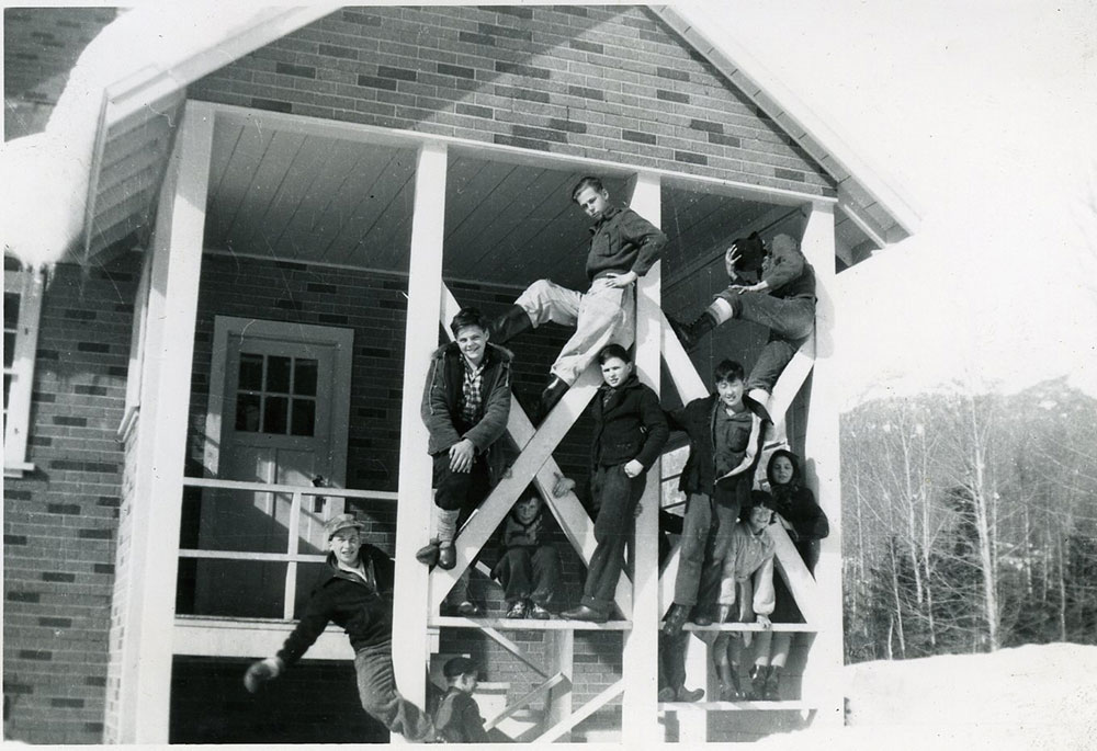
Children at Beaton School, 1953. RMA photo 6092. Photographer: Doris Warkentin.
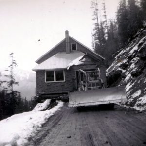
Moving Beaton School, 1968. RMA photo 12455.
Beaton was another community that was almost completely eliminated due to the Hugh Keenleyside Dam reservoir. In 1968, the Beaton schoolhouse, which had been built in 1951, was moved 17 km down a narrow, gravel road to the community of Trout Lake, where it is still in use as the community hall.
Beaton today has about 10 permanent residents, and about 35 summer properties. Only a few foundations remain of the former community.