

Founding a Colony on the St. Francis River
The British Crown opened up a vast area of land for settlement in southern Québec, known as the Eastern Townships, using a system of freehold land tenure. Townships were granted in perpetuity, could be transferred by inheritance, and were free from the rents which characterized the seigneurial system. The Colonial Office was responsible for allocating the new townships, often granting them to powerful men who were well connected. Over three million acres were thus granted to only a few hundred individuals who had little to no real interest in developing them. They engaged in land speculation, waiting for the demand to rise, along with its corresponding price increase for land which they themselves had received for free or for next to nothing. This was the case for two men: William Grant, a former receiver general and member of the Legislative Council who was awarded 27,000 acres in the Township of Grantham on May 14, 1800, and whose lands passed to John Richardson after his death in 1805, and William Lindsay, an assistant clerk of the Legislative Assembly, who was given almost 24,000 acres in the Township of Wickham on August 31, 1802.
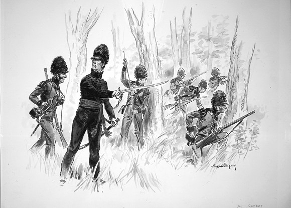
The Battle. Drawing by Eugène Leliepvre illustrating the Canadian Voltigeurs, circa 1812–1813.
In 1815, following the end of the War of 1812, discharged soldiers and officers were encouraged to settle a new area which encompassed the new townships along the St. Francis Valley. The objective was not only to begin cultivating previously uninhabited land, but to provide a military presence close to the American border and with access to the St. Lawrence River. Frederick George Heriot was appointed Superintendent and mandated by Sir Gordon Drummond, the Interim Governor of Upper and Lower Canada, to manage the new St. Francis settlement. Heriot was assisted by a second superintendent, Lieutenant-Colonel Pierre de Boucherville, and by Secretary and Storekeeper Lieutenant Joseph Stean, as well as by Captain Jacques Adhemar, and Lieutenants Smith, Hebden, and Prendergast. Adhemar was posted to William-Henry (today’s Sorel) to recruit colonists and to help them make arrangements for their journey to the new settlement.
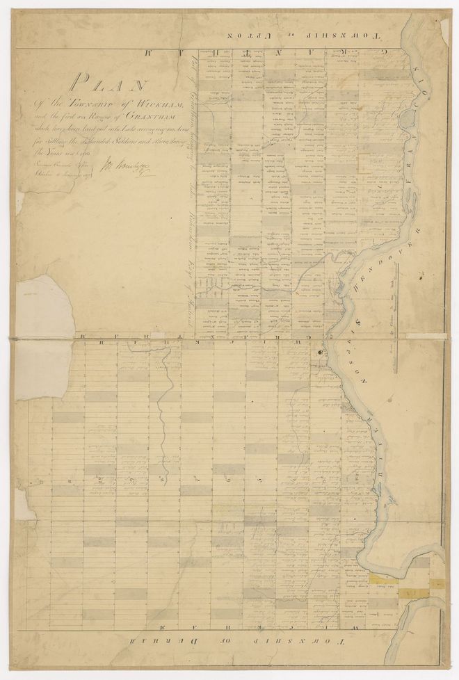
Map of the townships of Wickham and Grantham, by Joseph Bouchette, 1817.
While on an initial visit to explore the area, Heriot realized that many of the lots, especially those in Grantham and Wickham townships, were the property of absent land speculators. John Richardson and William Lindsay accepted a deal to exchange their lots for others to the south, since the alternative was expropriation. This paved the way for the colonizing efforts to go ahead. On June 29, 1815, Heriot and a group of British army veterans set foot on the islands that now make up Woodyatt Park to found the settlement. The fledgling town was named Drummondville, in honour of Sir Gordon Drummond.
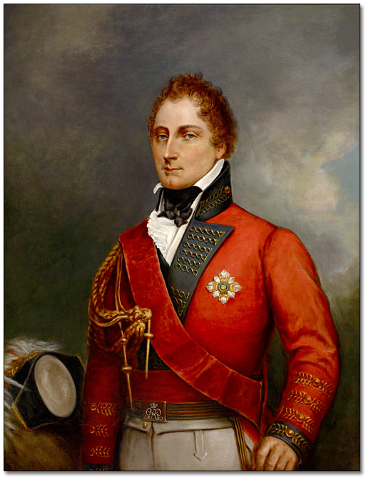
Oil on canvas of Sir Gordon Drummond, by George Theodore Berthon, 1883.