
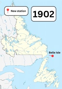
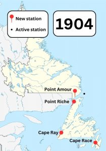
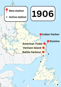
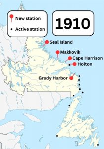
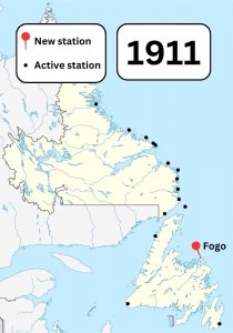
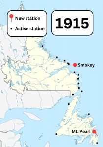
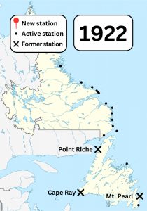
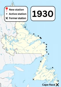
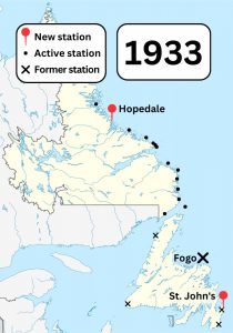
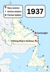
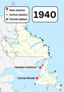
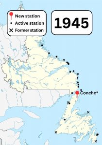
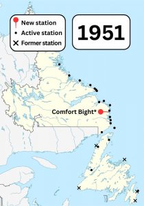
Timeline of Wireless Stations in Newfoundland and Labrador

This timeline shows the opening and closing dates of the Marconi wireless stations covered in this exhibit.

Asterisks (*) mark stations whose official opening years are unknown. These stations appear based on the earliest remaining evidence of their operation.

A colour map of Newfoundland and Labrador showing known Marconi wireless stations in the area in 1902. A pin shows a new station built in Belle Isle.A colour map of Newfoundland and Labrador showing known Marconi wireless stations in the area in 1904. Pins show new stations built in Point Amour, Point Riche, Cape Ray, and Cape Race.A colour map of Newfoundland and Labrador showing known Marconi wireless stations in the area in 1906. Pins show new stations built in Indian Harbor, Domino, American Tickle, Venison Island, and Battle Harbour.A colour map of Newfoundland and Labrador showing known Marconi wireless stations in the area in 1910. Pins show new stations built in Seal Island, Makkovik, Cape Harrison, Holton, and Grady Harbor.A colour map of Newfoundland and Labrador showing known Marconi wireless stations in the area in 1911. A pin shows a new station built in Fogo.A colour map of Newfoundland and Labrador showing known Marconi wireless stations in the area in 1915. Pins show new stations built in Smokey and Mt. Pearl.A colour map of Newfoundland and Labrador showing known Marconi wireless stations and former Marconi wireless stations in the area in 1922. Crosses show stations closed in Point Riche, Cape Ray, and Mt. Pearl.A colour map of Newfoundland and Labrador showing known Marconi wireless stations and former Marconi wireless stations in the area in 1930. A cross shows a station closed in Cape Race.A colour map of Newfoundland and Labrador showing known Marconi wireless stations and former Marconi wireless stations in the area in 1933. Pins show stations opened in Hopedale and St. John's. A cross shows a station closed in Fogo.A colour map of Newfoundland and Labrador showing known Marconi wireless stations and former Marconi wireless stations in the area in 1937. Pins show new stations built in Cartwright and Fishing Ship's Harbour.A colour map of Newfoundland and Labrador showing known Marconi wireless stations and former Marconi wireless stations in the area in 1940. Pins show new stations built in Hawkes Harbour and Corner Brook.A colour map of Newfoundland and Labrador showing known Marconi wireless stations and former Marconi wireless stations in the area in 1945. A pin shows a new station built in Conche.A colour map of Newfoundland and Labrador showing known Marconi wireless stations and former Marconi wireless stations in the area in 1951. A pin shows a new station built in Comfort Bight.