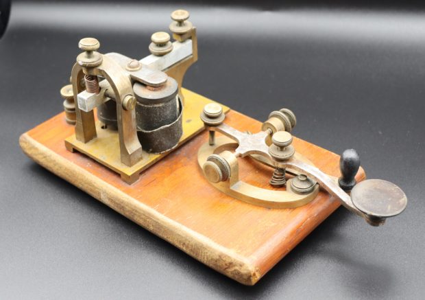
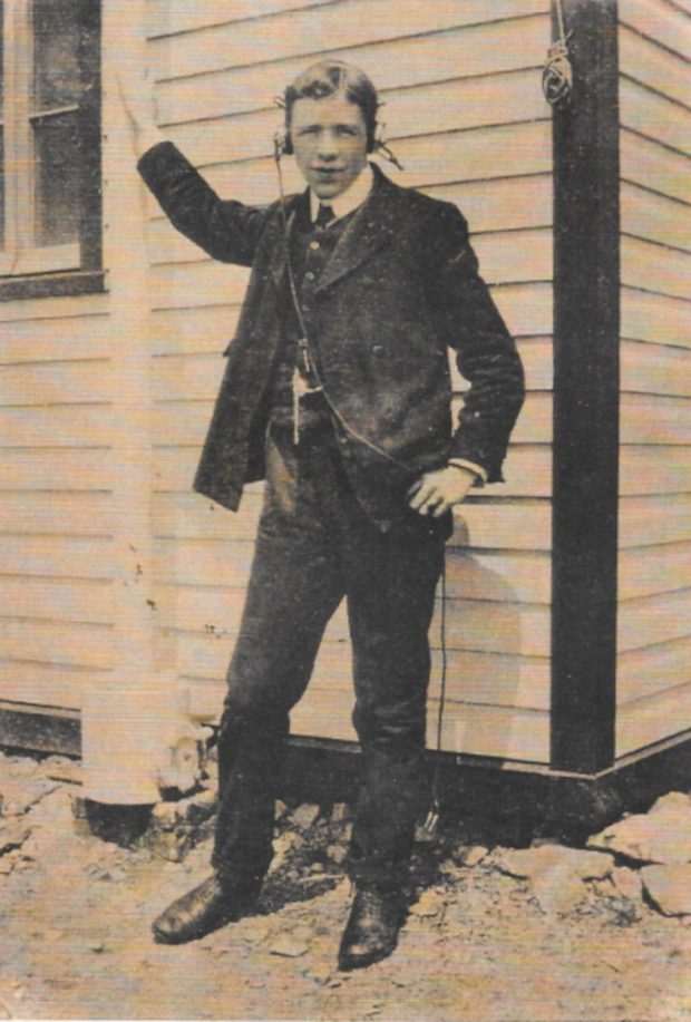
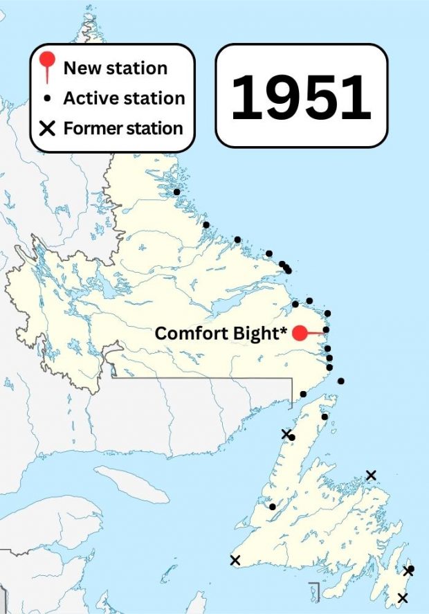
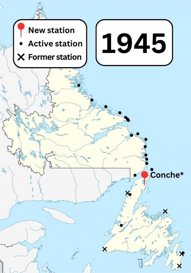
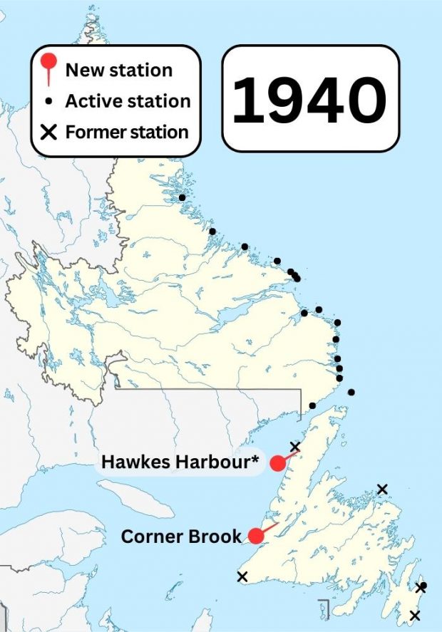
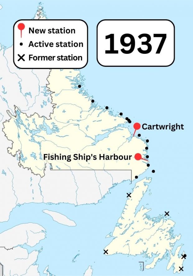
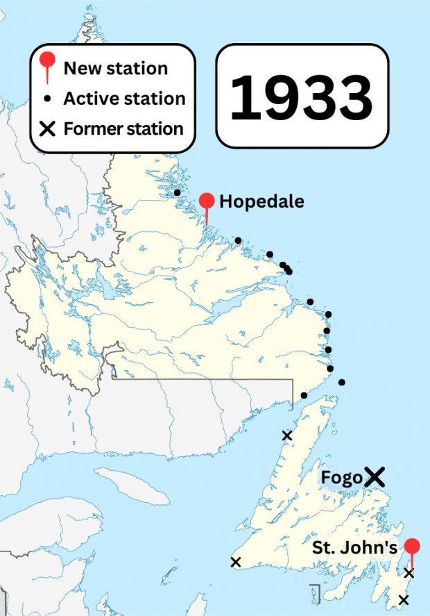
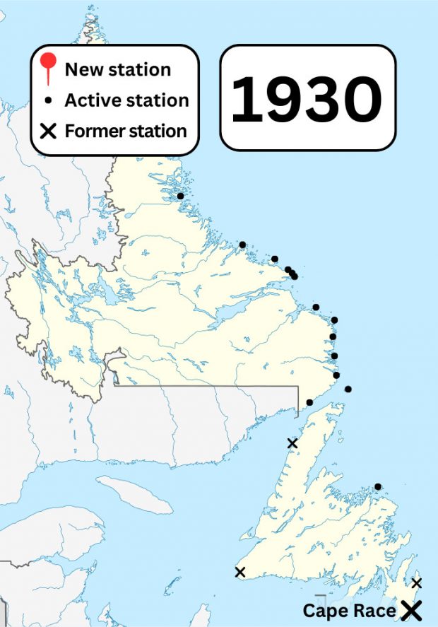
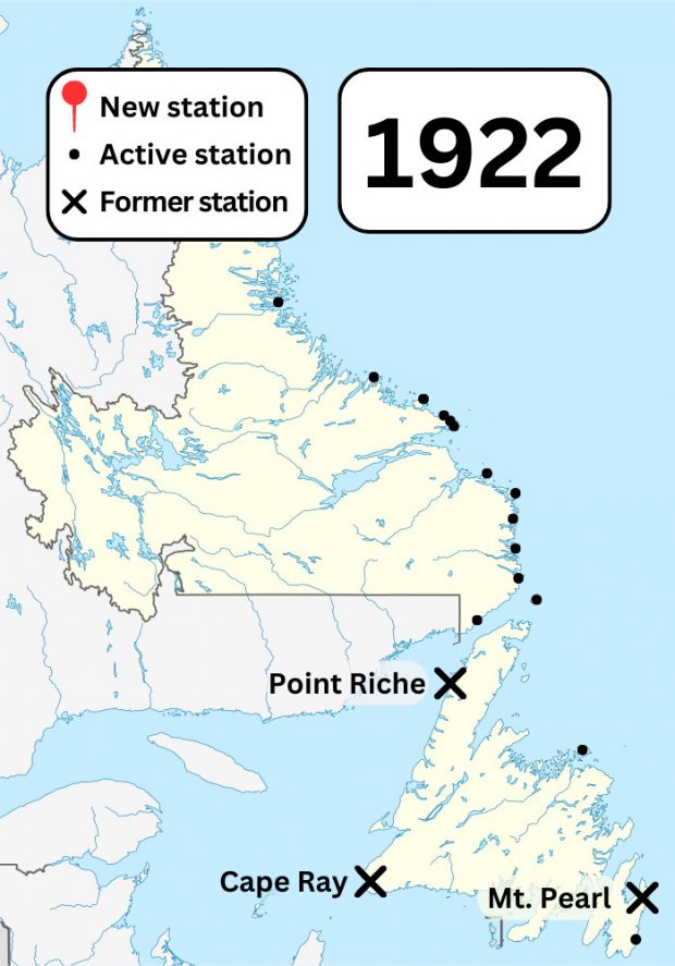
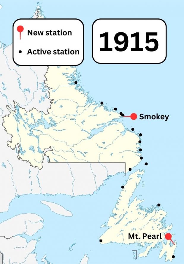
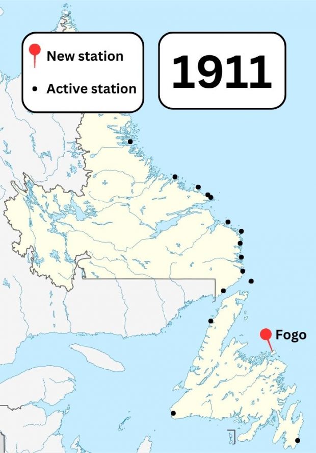
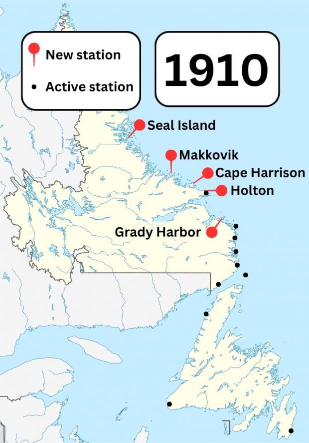
Gallery

Please browse the gallery below for all the images related to this exhibit. Select an item to see an enlarged image with the description.
Two small pieces of metal equipment are mounted on a wooden base.
A young man in a suit and vest stands before a clapboard building, his right arm raised to clasp a flagpole. He wears headphones and looks directly into the camera.
A colour map of Newfoundland and Labrador showing known Marconi wireless stations and former Marconi wireless stations in the area in 1951. A pin shows a new station built in Comfort Bight.
A colour map of Newfoundland and Labrador showing known Marconi wireless stations and former Marconi wireless stations in the area in 1945. A pin shows a new station built in Conche.
A colour map of Newfoundland and Labrador showing known Marconi wireless stations and former Marconi wireless stations in the area in 1940. Pins show new stations built in Hawkes Harbour and Corner Brook.
A colour map of Newfoundland and Labrador showing known Marconi wireless stations and former Marconi wireless stations in the area in 1937. Pins show new stations built in Cartwright and Fishing Ship's Harbour.
A colour map of Newfoundland and Labrador showing known Marconi wireless stations and former Marconi wireless stations in the area in 1933. Pins show stations opened in Hopedale and St. John's. A cross shows a station closed in Fogo.
A colour map of Newfoundland and Labrador showing known Marconi wireless stations and former Marconi wireless stations in the area in 1930. A cross shows a station closed in Cape Race.
A colour map of Newfoundland and Labrador showing known Marconi wireless stations and former Marconi wireless stations in the area in 1922. Crosses show stations closed in Point Riche, Cape Ray, and Mt. Pearl.
A colour map of Newfoundland and Labrador showing known Marconi wireless stations in the area in 1915. Pins show new stations built in Smokey and Mt. Pearl.
A colour map of Newfoundland and Labrador showing known Marconi wireless stations in the area in 1911. A pin shows a new station built in Fogo.
A colour map of Newfoundland and Labrador showing known Marconi wireless stations in the area in 1910. Pins show new stations built in Seal Island, Makkovik, Cape Harrison, Holton, and Grady Harbor.
  1. Page 1 of 4
  2. 1
  3. 2
  4. 3
  5. 4