

Sault-au-Récollet: from agriculture to urbanization
In the early 1700s, people used paths traced by Indigenous people to travel from the mission to Ville-Marie. Oral tradition long referred to a section of the path running alongside the Sault’s cemetery as the Chemin des Sauvages. In 2020, the City of Montreal officially renamed it Tetewaianón:ni Iakoiánaka’weh, or “messengers’ path” in the Mohawk tongue.
In the early days of the parish, roads were built: “Côte Saint-Michel” (now Crémazie Boulevard), “montée Saint-Michel” (now Saint-Michel Boulevard) and the “chemin du bord de l’eau” (now Gouin Boulevard). People first settled the eastern portion of the parish. When more land was cleared in the west, a second “montée” (road north), the “chemin du Sault-au-Récollet” was created. It is now Lajeunesse Street). Until the 20th century, all commuting was done via these roads. Businesses and services started popping up on Gouin Boulevard in the village: a blacksmith, a baker, a butcher, a general store, a hardware store, a doctor, a notary, and a post office.
The Viau Bridge crossed the Des Prairies River in 1848. As early as 1853, Jesuits built a novitiate in the western part of the village, followed later by the Convent of the Sacred Heart. Hamlets appeared in the periphery of a few inns at the intersections of the main roads: Saint-Michel, Ahuntsic and Bougie’s Corner (Youville).
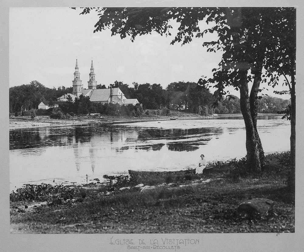
A woman dressed in white sitting in a small rowboat near a body of water. In the background, the Church of the Visitation.
The major shareholders of the Montreal Park & Island Railway Company, along with other public figures, would go on the maiden voyage of the tramway to the station near the Péloquin Hotel on December 28, 1893. Regular service started in 1894, eventually extending to the Sault-au-Récollet village in 1895. With the foundation of the Saint-Léonard-de-Port-Maurice village in 1886, the division of the parish’s land accelerated. Other villages would break away from the Sault: Villeray, Ahuntsic, Saint-Joseph-de-Bordeaux, Saint-Michel-de-Laval, and eventually Montréal-Nord.
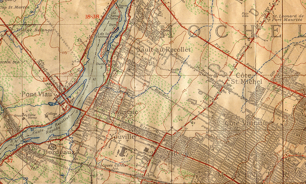
This detail of a topographical map from the early 1940s shows the village cores of Bordeaux, Ahuntsic, Youville, Saint-Michel and Sault-au-Récollet as still relatively distinct. 15 years later, they are intertwined into the City of Montreal.
Stéphane Tessier talks about the Sault’s oldest roads
Video with transcript (EN). Subtitles available in English and French.
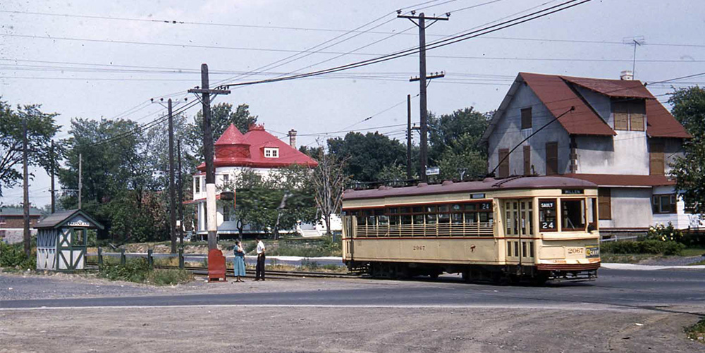
The 24 Millen-Sault tramway leaving the stop on Papineau Avenue, heading west toward the Ahuntsic station between 1953 and 1959. The tramway had been present in Sault-au-Récollet since 1895.
The tramway serviced the Sault up until 1959, via the 24 Millen-Sault line. From 1893 to that date, the region slowly became a residential neighbourhood of the City of Montreal.
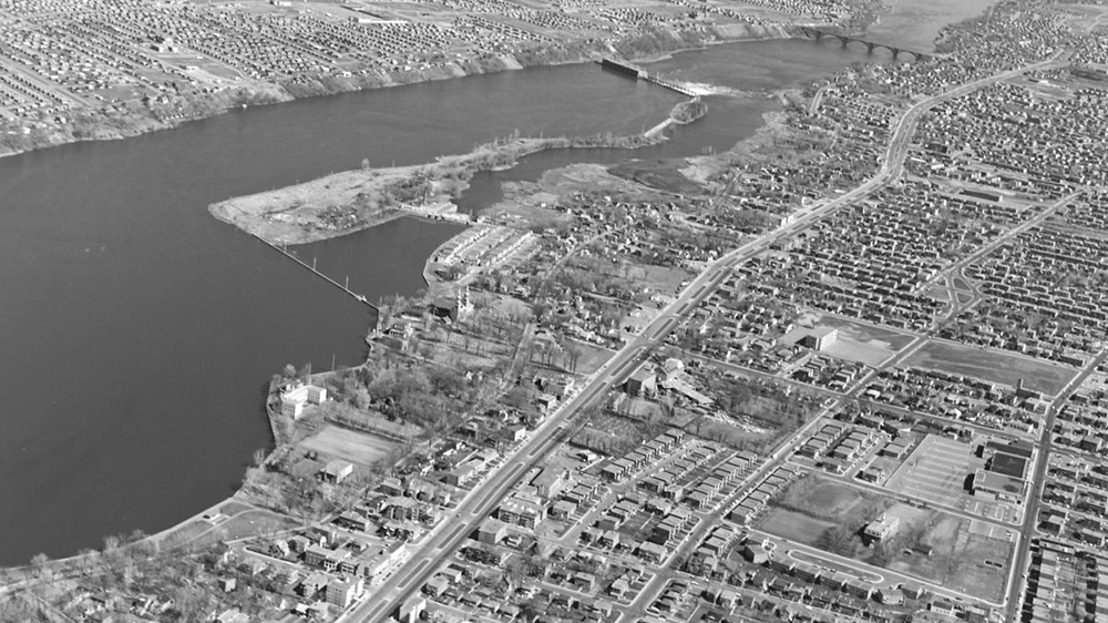
Aerial view of Sault-au-Récollet and the Des Prairies River hydroelectric power plant, July 7, 1963.