

Inhabiting and managing the land
The mills and church acted as a magnet for people who wanted to settle in Sault-au-Récollet. As seigneurs of the Island, the Sulpicians had the duty of building a flour mill. As Pehr Kalm reported: “By way of a contract signed between them (the Sulpicians) and the Island of Montreal’s inhabitants, the clergy had reserved the right to force the population to use their flour mills exclusively.”
This was a newly founded parish: “It wasn’t very long ago that the larger portion of it started being cultivated, as people have assured me that, in their youth, the land where the fields and farms now stretch was almost entirely covered by forest.”
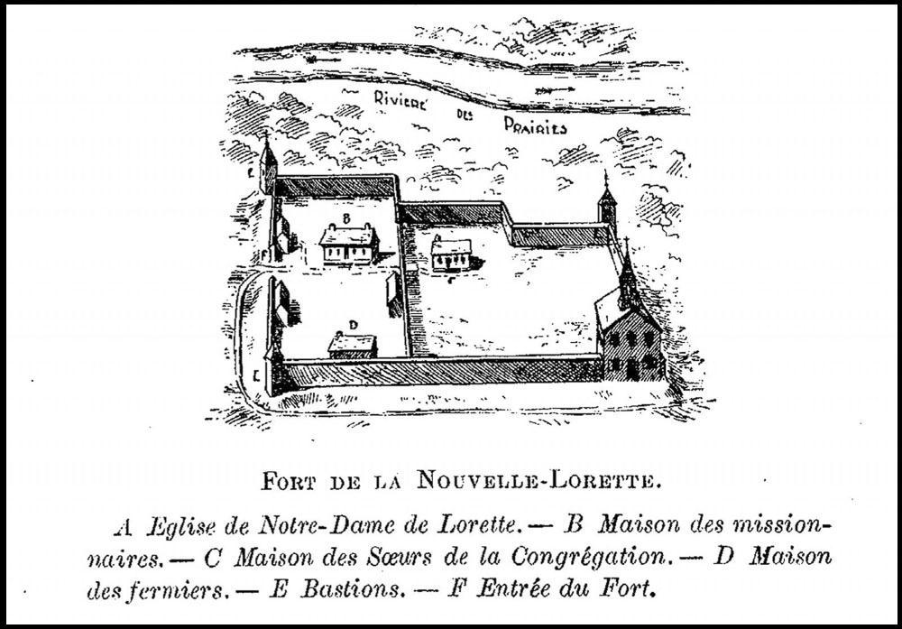
The Nouvelle-Lorette fort as depicted in the book “Le Sault-au-Récollet : ses rapports avec les premiers temps colonie : mission-paroisse” (“Sault-au-Récollet: its relationship with the early days of the colony: a mission-parish”), by Charles-Philippe Beaubien, the Sault’s parish priest, published in 1898.
In order to encourage Indigenous families to leave Sault-au-Récollet, the land was divided into three successive rows of conceded lots spread out parallel to the river. The first of these consisted of the plots cleared by the Skawenatironon who resided around the fort. These were the most valuable lands. The cleared area covered roughly seven square kilometres, and would reach as far as Sauvé Street today. The second range stretched up to Côte Saint-Michel (Jarry Street), with the third starting on its southern border.
New concessions would gradually surround the land exploited by the First Nations people. Pressure to leave increased on the last Indigenous families, as their fields started to become barren. As for the church, “the priest serving it wants to build a new stone one next year, in fact, some building materials including stone have already been brought to the site.”
Father Chambon wished to rally even the furthest parishioners to this ambitious project, namely the inhabitants of Côte Saint-Michel. To sway them, the Sulpician priest ordered a reproduction of a work from a great master all the way from France. Today still, visitors can admire this painting titled Le Grand Saint-Michel, which adorns the interior of Church of the Visitation.
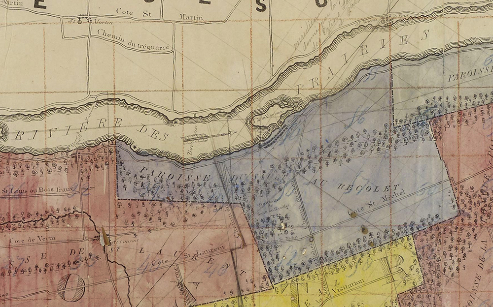
In blue, the territory of the Sault-au-Récollet parish as it appears on a hand-coloured copy of a map of the Island of Montreal by André Jobin, published in 1834.
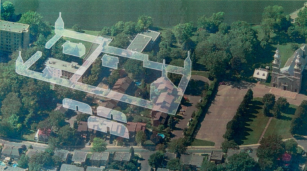
The Nouvelle-Lorette mission overlaid on the built environment of Sault-au-Récollet today. This representation shows the most likely location of the Indigenous village according to archaeologists. It is located behind the fort rather than upriver, closer to the shore.