

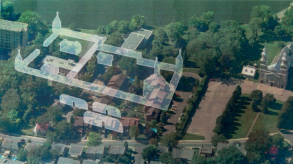
The Nouvelle-Lorette mission overlaid on the built environment of Sault-au-Récollet today
Société d’histoire d’Ahuntsic-Cartierville, Cité historia Fonds.
The Nouvelle-Lorette mission overlaid on the built environment of Sault-au-Récollet today. This representation shows the most likely location of the First Peoples’ village according to archaeologists. It is pictured behind the fort rather than upriver, closer to the shore.