Topographical map of the Sault-au-Récollet area sometime after 1940
![Detail of a topographical map (early 1940s). From left to right: Laval, the Des Prairies River, and the Island of Montreal. The village core of Sault-au-Récollet, at the top centre. Lighter-coloured areas are less urbanized. The villages of Bordeaux, Ahuntsic, Youville, Saint-Michel remain relatively distinct from one another.](https://www.communitystories.ca/v2/moulins-ile-de-la-visitation_mills/wp-content/uploads/sites/167/2022/04/Circa-1940_Carte-topographique-non-datee_Via-Celine-Menard-copie.jpg)
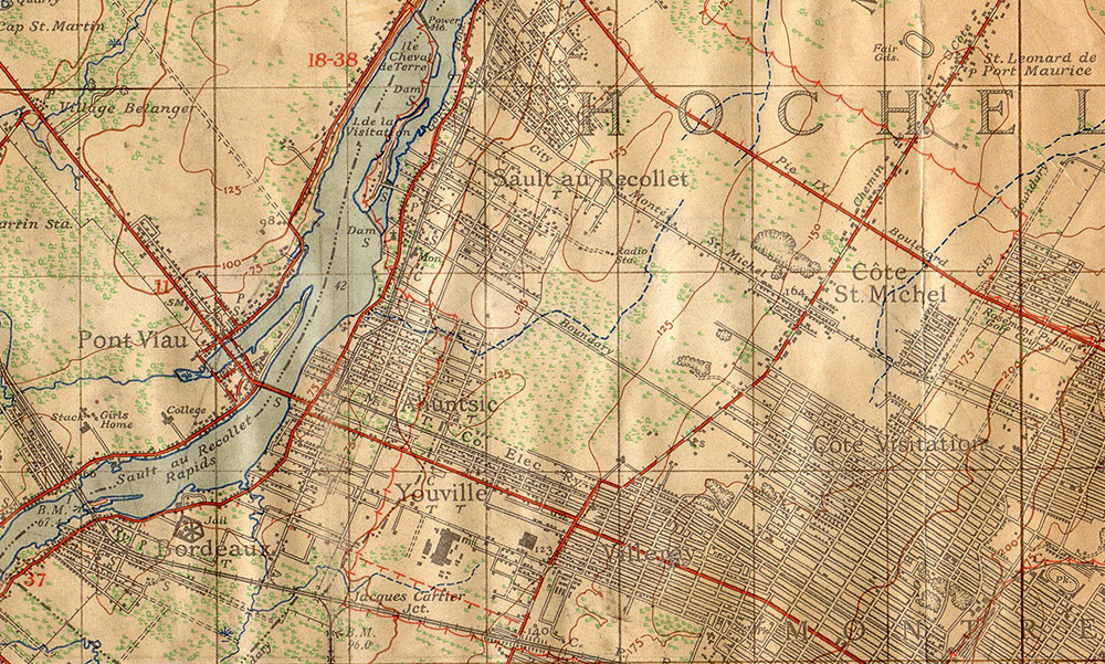
Detail of an undated map. Courtesy of Mrs. Céline Ménard.
This detail of a topographical map from the early 1940s shows the village cores of Bordeaux, Ahuntsic, Youville, Saint-Michel and Sault-au-Récollet as still relatively distinct. 15 years later, they have been intregrated into the City of Montreal.