

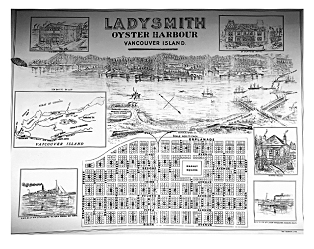
Promotional Map Of Planned Town Of Ladysmith
Source: Ladysmith Archives
Date: Circa 1902
Ladysmith B.C., was planned by the industrialist James Dunsmuir to house the miners who worked his coal mines at Extension, 16 kilometers to the north. Located on the west shore of Oyster (later called Ladysmith) Harbour, the town was set out in a grid pattern, with avenues running north-south and streets, named after Boer War generals, east-west. This map is an example of the early promotion of the town to settlers and businesspeople.