

Insurance Map of the City of Shawinigan Falls (September 1955)
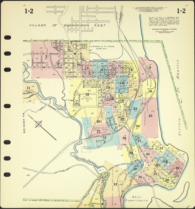
Saint-Marc is an old working-class neighbourhood that has been at the centre of life in Shawinigan since the city was founded. The area was hit hard by waves of industrial decline in the 1970s and 1980s, and again in the 2010s. As shown on the insurance map published by the Underwriters’ Survey Bureau in 1955, the neighbourhood sprang up around different major employers. Shawinigan Chemicals Limited and the Canadian Carborundum Company were located near the Saint-Maurice River. Alcan had set up shop to the north and Dupont could be found to the south, where it was hemmed in by the Shawinigan River and the tracks of the Canadian National Railways. This all made the area highly sensitive to industrial decline and limited the potential for active transportation.