

Fields and Formats – The Layout of the Metis Seigneurie
Photograph
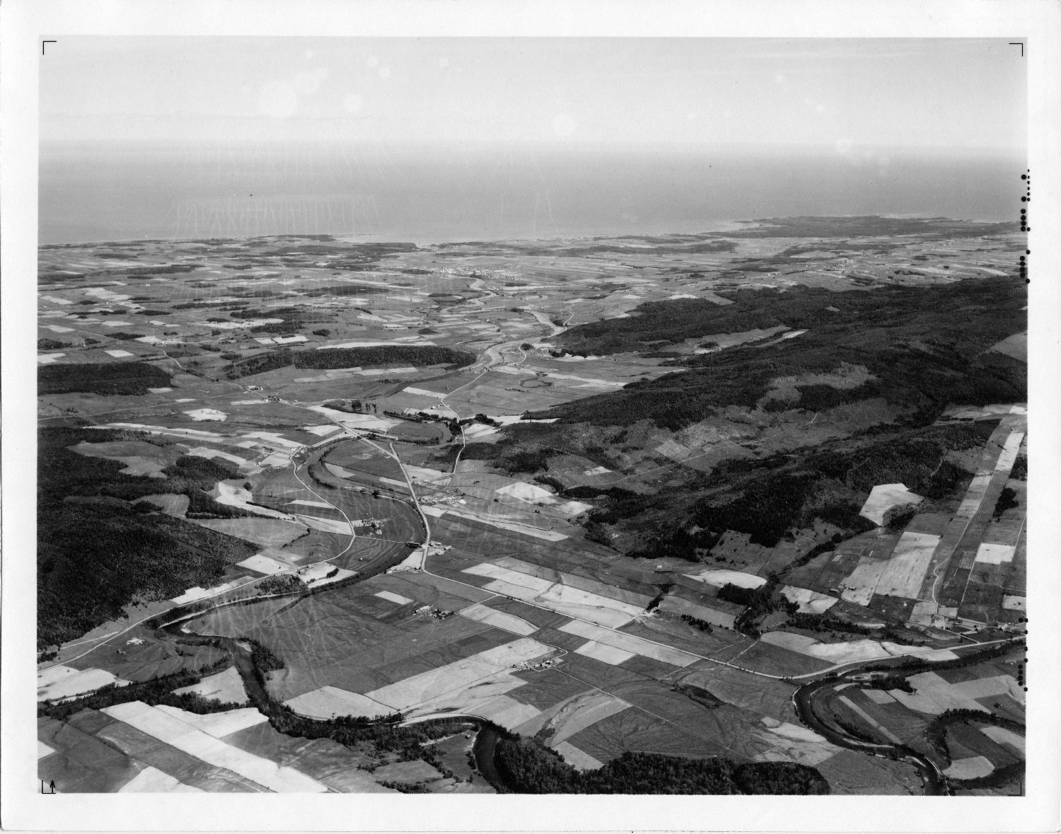
Seigneurie Lepage and Thibierge Metis River Area (Mitis River), 1938
Canadian Airways Limited
Bibliothèque et Archives nationales du Québec
Metis was laid out using the seigneurial system. Here as in other parts of Quebec, this meant that the farms were long strips about 1 mile in length, the width of a single field, 350 to 600 feet across. The lots began from the height of a horse’s shoulder standing in the St. Lawrence and stretched back to the south. The house, barn and stables were crowded near the coastal road. Pastures and fields were next. Forests of poplar, birch, cedar and maple were left intact at the top of the farm, providing much needed firewood or fencing materials. The shoreline could not be farmed because it was crowded with debris from tides and storms and infertile sand and stone colonized by shoreline plants.
The best soil was on either side of the second range, flat and well-drained. In Metis, this was baptised the “Rang des Écossais”, honouring the Scottish farmers whose farms were productive and prosperous. Farms there had the advantage of being protected from the strong winds whistling off the river. Almost every square inch of arable land was under cultivation, farmers eking out a living by cultivating every nook and cranny. This created a beautiful patchwork of fields. The same pattern remains today, but the mix of fields and forests has evolved, much of the land once cultivated long since reclaimed by nature.
Macnider reserved two parcels of land for himself, a domaine at the mouth of the Metis River and another on the spit of land where a lighthouse would later be erected. He built modest manor houses on each property. Vestiges of the foundations of the manor near the river were recently unearthed by archaeologists. The manor house at Lighthouse Point twice succumbed to flames. Rebuilt by the Fergusons, it was torn down in the 1950s.