Category: Map & Chart
- Buildings & Structures
- Document
- Events
- General
- Landscape
- Object
- People
- Sex
- Sports & Games
- Transport
- Type
- Work


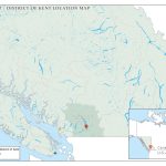
Knee High by the First of July: Celebrating the Legacy of Corn in the District of Kent, British Columbia Knee High by the First of July The Agassiz-Harrison Historical Society