

The Côte-du-Sud, more than just a coastline
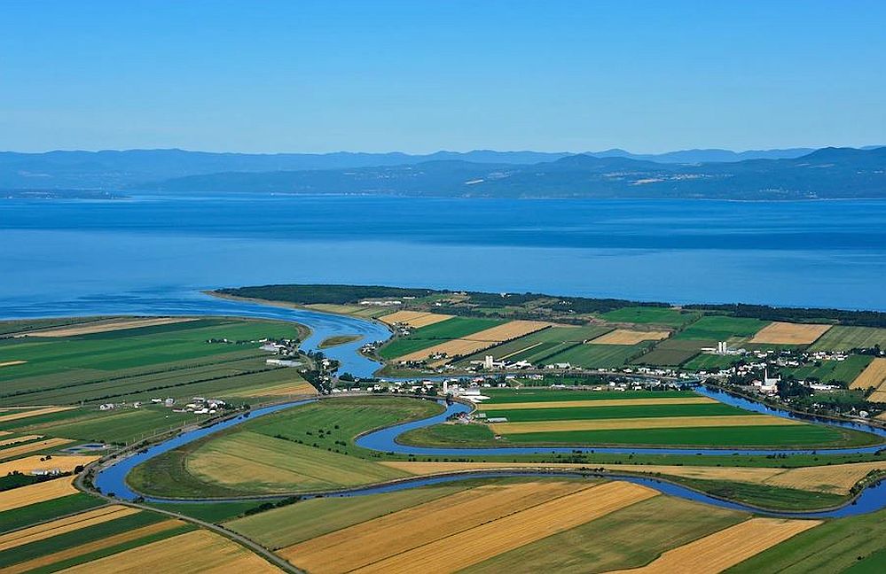
Aerial view of a landscape of the Côte-du-Sud, 2015
The Ouelle River and the municipality of Rivière-Ouelle
Copyright: Pierre Lahoud
The Côte-du-Sud is well-defined. It begins some 30 km east of the Quebec Bridge, at Beaumont, and ends at Saint-André de Kamouraska, nearly 200 km further east. It stretches from the shore of the St. Lawrence to the U.S. border.
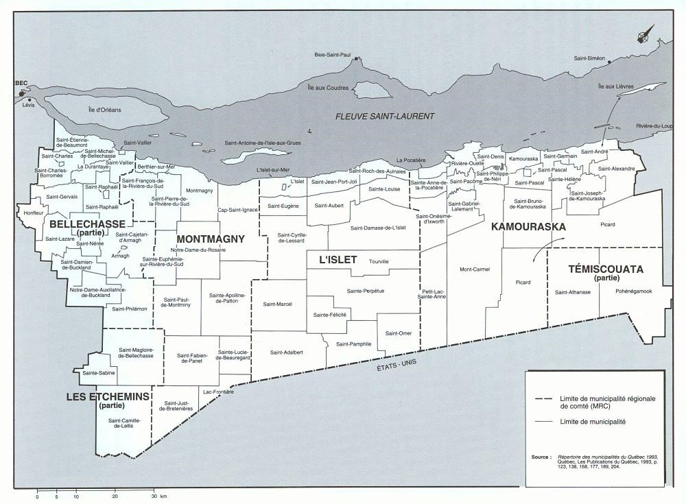
Map of the Côte-du-Sud, source: Histoire de la Côte-du-Sud, edited by Alain Laberge, IQRS, 1979
“Côte-du-Sud” is a very old name that was given to one of the first territories to be populated when the Europeans arrived. Texts written in Old French by missionaries and dating from as early as 1663 talk about the “Coste du Sud”. It is therefore an historic region as well as a tourist one, thanks to the presence of the river, among other things.