

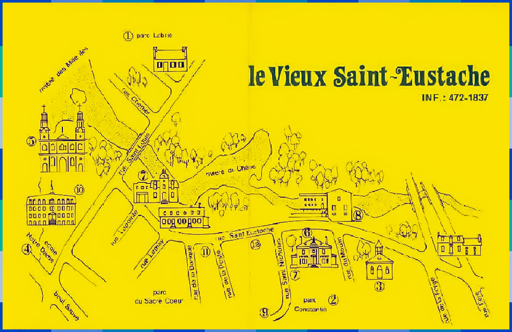
The 1977 map of the Fêtes du Vieux-Saint-Eustache
Unknown, 1977.
City of Saint-Eustache. Archives. Fonds de la Corporation des Fêtes du Vieux-Saint-Eustache.
This map was handed out to visitors; it shows the area where most of the activities of the Fêtes du Vieux Saint-Eustache took place: Old Saint-Eustache from Labrie Park to the little Protestant church.
In addition to the telephone number for the event, various points of interest, including a number of heritage buildings, are identified on the map. It shows the little Protestant church (3 on the map), Globensky Manor (6), the Légaré mill (8), the J.A. Paquin general store (7) and the Saint-Eustache church (5). You will notice that most of these points of interest are located on Saint-Eustache and Saint-Louis Streets.