

13 – Navigational Tools
In the planning stage of building the huts, many hours were spent pouring over the topographical maps of a planned site. While topographical maps are still important, the development of portable GPS locators, Route Finders, and even smart phones (if cell service is available) has changed how sites are chosen and found. These advancements have helped in planning for club trips and also finding new routes to climb or summit peaks.
Topographical map of the Garibaldi Neve
Mountaineering and outdoor recreation clubs have also served as important sources of information on trails, climbing routes, and backcountry access issues.
In the past, visitors would learn about destinations through a guidebook. Books could shine attention on specific areas but the crowds were spread out over time and over all of the destinations in the book.[18]
Dick Culbert and Glenn Woodsworth published the first comprehensive guide to the alpine regions of southwestern British Columbia in 1965. The guidebook not only examined climbing routes but also provided detail on the flora and fauna found within the alpine ecosystem of the Coast Mountain Range. John Baldwin, renowned backcountry skier, has written several guidebooks on skiing in the backcountry of the Coast Mountains.
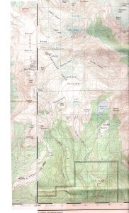
Topographical map of the trail route to Watersprite Lake
Follow this link to explore a Google Map showing hut locations by geographical coordinates. Please note that this map does not provide trail access information. If you are planning to use the huts, please consult trail or route information or contact the club operating the hut directly through their websites.
[18] Jones, Steve. Social Media and the Backcountry. Cloudburst. Spring/Summer 2017. Pg. 8