

Protecting the shipwreck of S.S. “Caribou”
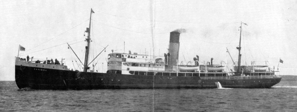
S.S. “Caribou”
Unlike modern digital records, the ship logs of both H.M.C.S. Grandmere and U-69 were subject to human error. S.S. Caribou’s helmsman Able Seaman Jack Dominie had a good estimate of where the ferry was struck.
S.S. Caribou lies approximately 38 km southwest of Newfoundland, at a depth of roughly 450 m— but its exact location is still unknown. If located, the wreck could only be visited with a submarine or a remotely operated vehicle (ROV).
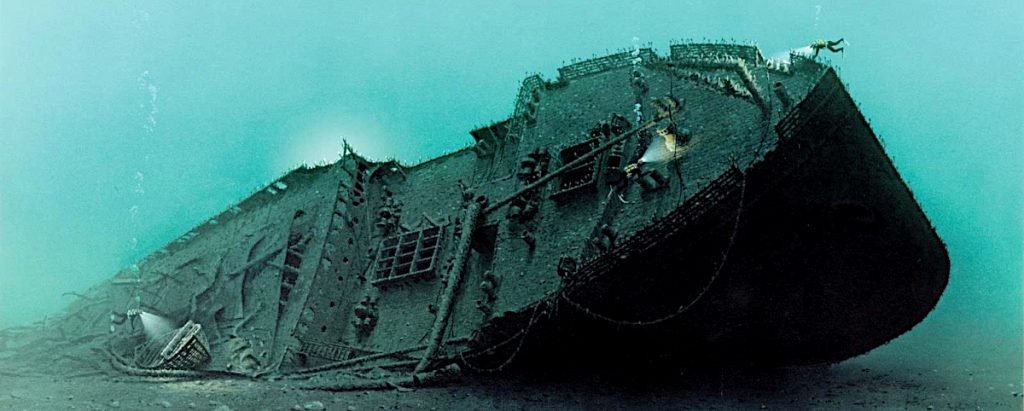
Sunken shipwreck on the seafloor
In 1942, Captain Benjamin Taverner steered S.S. Caribou across the Cabot Strait relying on his skill, local knowledge, and luck. Today’s navigators can find even deep-water shipwrecks, but they use vessels equipped with sidescan or multibeam sonar equipment. Hopefully, the wreck of S.S. Caribou will be located and protected as a nationally significant shipwreck.
The bottom of the Cabot Strait holds two other ships sunk by German U-boats: S.S. Waterton, and the corvette H.M.C.S. Shawinigan. Unlike the former vessel, the shipwrecks of S.S. Caribou and H.M.C.S. Shawinigan are also gravesites. Of the 80 Allied merchant ships, six Royal Canadian Navy warships, and four U-boats from the German Navy that were sunk in Newfoundland and Canadian waters in World War II, not one is a protected heritage site or designated war grave.
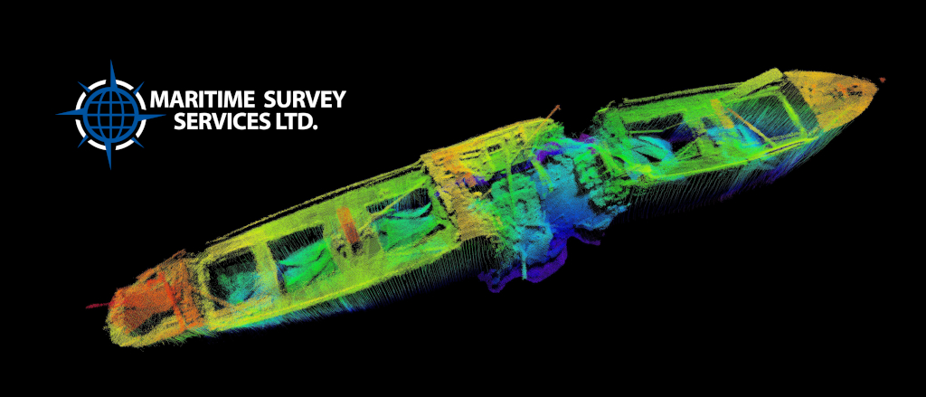
Multibeam sonar image of a World War II shipwreck off Newfoundland
Groups like the Shipwreck Preservation Society of Newfoundland and Labrador locate and document shipwrecks, and raise awareness of our shipwreck history and the need for their protection. The stories of these ships and of their crews and passengers form an important part of our provincial and national heritage.