

Map of Manitoba issued by the Provincial Government
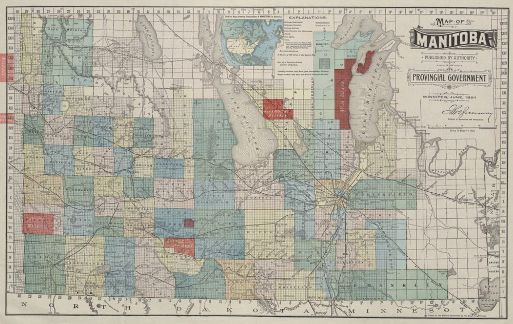
Image courtesy of Library and Archives Canada
A colourful 1891 map of Manitoba showing surveyed township grids, railways, and natural landmarks. This map, issued by the Provincial Government was used to promote immigration and guide settlement, infrastructure development, and land sales in a rapidly growing province. New Iceland appears along the western shore of Lake Winnipeg. The map includes numbered ranges and townships, variously shaded blocks indicating land status, and inset diagrams of Winnipeg and northern Lake Winnipeg. This version of the map features rural areas with large Icelandic settlements marked in red.