1
Townships in Temiskaming where laid in a conventional grid fashion similar to southern Ontario. This was done with no accommodation of major geographical features. It was perhaps the easiest way to get the jobs done. The main map used for this chapter, is one published in 1922 by the Ontario Bureau of Mines. It?s a geology map but was laid over a topographical base map and since the topographical map was created before the Great Fire of 1922, all the buildings and farmsteads are shown as they were before the conflagration. This has been an invaluable tool for historical research when tracing the settlement pattern and the location of long destroyed homes.Each township considered to be South Temiskaming has been cut out as a detailed map of a single township. It is hoped that this resources will become an educational tool for research and study.
2
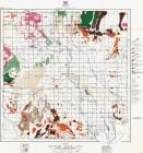
Townships of South Temiskaming20th Century, Circa1922
District of Temiskaming, Ontario, Canada
 Credits:
Ministry of Northern Development & Mines, Ontario.
3
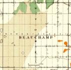
Beauchamp township map1922
Beauchamp township, District of Temiskaming, Ontario.
4
Brethour township map1922
Brethour township, District of Temiskaming, Ontario.
5
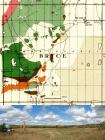
Bryce township map1922
Bryce township, District of Temiskaming, Ontario.
6
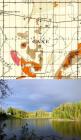
Cane township map1922
Cane township, District of Temiskaming, Ontario.
7
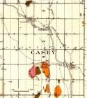
Casey township map1922
Casey township, District of Temiskaming, Ontario.
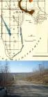
8
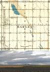
Harley township map1922
Harley township, District of Temiskaming, Ontario
9
Harris township map1922
Harris township, District of Temiskaming, Ontario.
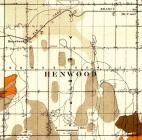
10
Henwood township map1922
Henwood township, District of Temiskaming, Ontario.
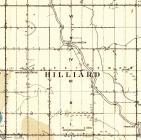
11
Hilliard township map1922
Hilliard township, District of Temiskaming, Ontario.
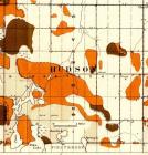
12
Hudson township map1922
Hudson Township, District of Temiskaming
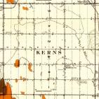
13
Kerns township map1922
Kerns Township, District of Temiskaming, Ontario
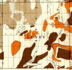
14
Lundy township map1922
Lundy township, District of Temiskaming, Ontario.